如下图所示: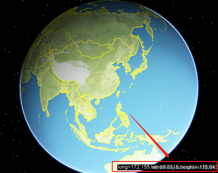
MouseIntersection.h
#ifndef MOUSEINTERSECTION_H
#define MOUSEINTERSECTION_H

#include <osgGA/GUIEventHandler>
#include <osgEarthUtil/Controls>

//经纬度标牌显示

class MouseIntersection : public osgGA::GUIEventHandler {
public:
	MouseIntersection();
	virtual ~MouseIntersection();

	osgEarth::Util::Controls::LabelControl*getLabel() {
		return _label;
	}
private:
	void buildLabelControls();
	bool handle(const osgGA::GUIEventAdapter& ea, osgGA::GUIActionAdapter& aa)override;
private:
	osgEarth::Util::Controls::LabelControl* _label;
};

#endif // MOUSEINTERSECTION_H
MouseIntersection.cpp
#include "MouseIntersection.h"
#include "EarthMapManager.h"
#include <osgEarthUtil/Controls>
#include <osg/Node>
#include <sstream>
MouseIntersection::MouseIntersection() {
	buildLabelControls();
}

MouseIntersection::~MouseIntersection() {

}

void MouseIntersection::buildLabelControls() {
	EarthMapMgr()->getRoot()->addChild(osgEarth::Util::Controls::ControlCanvas::get(EarthMapMgr()->getViewer()));
	osgEarth::Util::Controls::ControlCanvas* canvas = osgEarth::Util::Controls::ControlCanvas::get(EarthMapMgr()->getViewer());

	_label = new osgEarth::Util::Controls::LabelControl;
	_label->setText("label test");
	_label->setHorizAlign(osgEarth::Util::Controls::LabelControl::Alignment::ALIGN_LEFT);
	_label->setVertAlign(osgEarth::Util::Controls::LabelControl::Alignment::ALIGN_BOTTOM);
	//_label->setEncoding(osgText::String::Encoding::ENCODING_ASCII);
	_label->setMargin(osgEarth::Util::Controls::LabelControl::Side::SIDE_BOTTOM, 10.0);
	_label->setBackColor(osg::Vec4(0, 0, 0, 0.2));
	canvas->addControl(_label);

	// 添加中文字体
	osg::ref_ptr<osgText::Text> t = new osgText::Text;
	t->setFont("./Map/3D/fonts/simsun.ttc");
	_label->setFont(t->getFont());
	_label->setEncoding(osgText::String::Encoding::ENCODING_UTF8);
}

bool MouseIntersection::handle(const osgGA::GUIEventAdapter& ea, osgGA::GUIActionAdapter& aa) {
	if (ea.getEventType() == osgGA::GUIEventAdapter::MOVE || ea.getEventType() == osgGA::GUIEventAdapter::DRAG) {
		osgUtil::LineSegmentIntersector::Intersections intersections;
		osg::NodePath np;

		np.push_back(EarthMapMgr()->getMapNode());
		if (EarthMapMgr()->getViewer()->computeIntersections(ea.getX(), ea.getY(), np, intersections)) {
			if (intersections.size() >= 1) {
				osgUtil::LineSegmentIntersector::Intersections::iterator it = intersections.begin();
				osg::Vec3d point;
				point = it->getWorldIntersectPoint();
				double latitude = 0.0;
				double longitude = 0.0;
				double height = 0.0;
				EarthMapMgr()->getMapNode()->getMapSRS()->getEllipsoid()
					->convertXYZToLatLongHeight(point.x(), point.y(), point.z(), latitude, longitude, height);
				QString context = QString::fromLocal8Bit("经度:") + QString::number(osg::RadiansToDegrees(longitude)) + ", "
					+ QString::fromLocal8Bit("纬度:") + QString::number(osg::RadiansToDegrees(latitude)) + ", "
					+ QString::fromLocal8Bit("海拔:") + QString::number(height);
				_label->setText(context.toStdString());
			}
		}
	}

	return false;
}
调用:
	osg::ref_ptr<MouseIntersection> mouseInter;
	mouseInter = new MouseIntersection;
	_viewer->addEventHandler(mouseInter);

	_root->addChild(mouseInter->getLabel());
aaa
版权声明:本文为wb175208原创文章,遵循CC 4.0 BY-SA版权协议,转载请附上原文出处链接和本声明。